
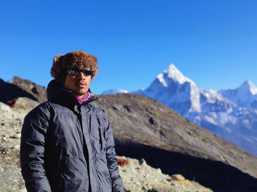


# Manang & Mustang on the Annapurna Circuit – A Trekker’s Guide to the High Country
Why Manang and Mustang Define the Annapurna Circuit
The Annapurna Circuit is rightly famous as one of the world’s great teahouse treks, but the stretch that gives it its soul is the long arc through Manang and on toward the rain-shadow land of Mustang. This is where the green, terraced middle hills give way to a high, arid plateau ringed by six-thousand and eight-thousand-metre peaks, where Tibetan-influenced culture replaces the Gurung and Magar villages of the south, and where the air turns thin enough that every step becomes a measured decision. For many trekkers the Manang-to-Mustang corridor – the northern limb of the circuit before the climb to Thorong La – is the part they remember longest.
Annapurna Circuit Treks runs the full Circuit from our Pokhara base, and our licensed guides know every lodge, every side valley, and every altitude trap on this northern limb. This guide walks the geography, the culture, the acclimatisation logic, and the practical day-by-day reality of walking from Manang toward Muktinath and the edge of Upper Mustang. Our [dedicated Manang and Mustang Circuit guide](https://annapurnacircuittreks.com/manang-mustang-annapurna-circuit-trek-nepal/) is the flagship resource, and the [full Annapurna Circuit trek guide](https://annapurnacircuittreks.com/annapurna-circuit-trek-guide/) explains the route as a whole. If you want Tilicho Lake folded into the same walk, the [Circuit with Tilicho route](https://annapurnacircuittreks.com/annapurna-circuit-with-tilicho-lake-trek/) is the version to read.
The Geography – From Green Hills to High Desert
The magic of this corridor is geological. The Annapurna massif forms a wall that catches the summer monsoon on its southern flank, so the land south of the crest is wet, forested, and farmed. North of that crest – beyond Manang and into the Kali Gandaki and Mustang – lies a rain shadow. The monsoon clouds spend their rain on the south face and arrive on the northern side as dry, desiccated air. The result is a Tibetan-style landscape of eroded clay cliffs, sparse scrub, and a sky of brutal, clarifying clarity.
Manang itself sits at about 3,540 m in a broad, windswept bowl beneath the Annapurna IV and Gangapurna peaks, fed by meltwater from the Gangapurna glacier. As you continue north and west the valley opens toward the Kali Gandaki gorge – the deepest gorge on Earth relative to the surrounding peaks – and toward the plateau of Mustang, where the land flattens into a cold, ochre expanse. The [region geography guide](https://annapurnacircuittreks.com/things-to-do-in-annapurna-region/) explains how this rain-shadow physics shapes everything from the vegetation to the architecture, and the [how to reach the region guide](https://annapurnacircuittreks.com/annapurna-travel-guide-2026/) covers the approach from Pokhara via Besisahar and the steadily climbing road.
Manang Village (3,540 m) – The Heart of the High Circuit
Manang is the pivot of the northern Circuit. It is large enough to have shops, bakeries, a bank counter, and the important Himalayan Rescue Association (HRA) health post, yet small enough that the mountains press right against the rooftops. Trekkers arrive here after days of climbing from the humid lowlands and use it as the key acclimatisation halt before Thorong La. Most itineraries build in two nights.
The HRA clinic at Manang is one of only two altitude-medicine posts on the whole circuit (the other is at Pheriche, on the Everest side of things), and it runs a daily lecture on recognising altitude sickness – essential listening for anyone climbing higher. The [HRA clinics guide](https://annapurnacircuittreks.com/hra-clinics-annapurna-route/) explains what the post offers, and the [acclimatisation strategy for Tilicho and Thorong](https://annapurnacircuittreks.com/acclimatisation-strategy-tilicho-thorong/) shows how to use the extra days productively. From Manang you can also take the [Ice Lake acclimatisation hike](https://annapurnacircuittreks.com/ice-lake-manang-acclimatization-hike/) or push on toward Tilicho Base Camp – both of which we cover in their own sections below.
Acclimatisation Logic – Why Manang Demands Rest
Altitude illness is the single biggest risk on the northern Circuit, and Manang is where the rule is taught: climb high, sleep low, and never gain more than about 500 m of sleeping altitude per day above 3,000 m. Because Thorong La at 5,416 m is a brutal day above Manang, your body needs to be thoroughly adapted before you attempt it. That is why our itineraries treat Manang as a two-night minimum and fill the spare day with a hike to 4,000 m plus and back down.
The physiology is simple but unforgiving. Above 2,500 m the air holds roughly 26 percent less oxygen than at sea level, and at Manang’s 3,540 m your blood is already working harder to deliver oxygen to your muscles. A rest day lets your body manufacture more red blood cells and adjust its breathing pattern. The [altitude sickness guide](https://annapurnacircuittreks.com/altitude-sickness-annapurna-circuit/) and the [trek safety and altitude guide](https://annapurnacircuittreks.com/annapurna-trek-safety-altitude/) lay out the warning signs – a worsening headache, loss of appetite, breathlessness at rest – that mean you should not climb. Our guides carry pulse oximeters and a clear evacuation plan, and the [trekking emergency guide](https://annapurnacircuittreks.com/trekking-emergency-annapurna-what-to-do/) explains what happens if someone cannot continue.
The Ice Lake Hike – Manang’s Best Acclimatisation Day Walk
On the rest day at Manang, the classic acclimatisation walk is the climb to Ice Lake, known locally as Kicho Tal. The trail leaves the village and rises steeply through a side valley, past mani walls and a small gompa, to a glacial tarn at around 4,600 m set beneath a hanging glacier. You climb high and return to Manang the same day, which is exactly the stimulus your body needs.
The walk is hard – roughly 800-1,000 m of ascent – but the reward is a mirror-still lake flanked by ice and scree, with the Gangapurna and Khangsar Kang walls towering above. It is covered in full detail in our [Ice Lake acclimatisation hike guide](https://annapurnacircuittreks.com/ice-lake-manang-acclimatization-hike/), and it pairs naturally with the [Manang and Mustang Circuit guide](https://annapurnacircuittreks.com/manang-mustang-annapurna-circuit-trek-nepal/). Trekkers who do this walk almost always cope better with Thorong La the following day, which is the whole point of the exercise.
Tilicho Lake (4,949 m) – The High Side Trip
From Manang a demanding side trip climbs to Tilicho Lake at 4,949 m, one of the highest large lakes on the planet, set in a bowl beneath the Tilicho peak and the great north face of Nilgiri. The standard approach is a long day to Tilicho Base Camp (around 4,150 m) and a second day up to the lake and back, or an overnight at the rudimentary lakeside lodge. The lake itself is a surreal, wind-scoured expanse of deep blue water under a wall of snow.
Adding Tilicho extends the Circuit by two or three days and is best done before the Thorong crossing so you acclimatise progressively. The [Annapurna Circuit with Tilicho Lake](https://annapurnacircuittreks.com/annapurna-circuit-with-tilicho-lake-trek/) is the package we recommend, and the [15-day Circuit with Tilicho trek](https://annapurnacircuittreks.com/trip/15-days-annapurna-circuit-tilicho-lake-trek/) is the fixed-departure version. Because the Tilicho route rejoins the main circuit near Khangsar, it also opens the dramatic option of crossing the Mesokanto La into Upper Mustang – a route for strong, well-prepared trekkers with a licensed guide. Permits for that restricted zone are covered in our [permits guide](https://annapurnacircuittreks.com/annapurna-trekking-permits-2026/).
Khangsar and the Road to Muktinath
Above Manang the trail climbs past the village of Khangsar (about 3,700 m) and then splits: the classic route diverts to Tilicho or continues up to Thorong Phedi and High Camp below the pass, while the road-walk alternative descends the Kali Gandaki toward Muktinath at 3,800 m. Muktinath is the sacred site where the Circuit’s northern limb effectively ends, and from there the descent to Jomsom and the gorge begins.
The arrival of the jeep road has changed this section enormously. What was once a pure walking route now has vehicle traffic as far as Manang and beyond in places, which is a mixed blessing: easier logistics and evacuation, but more dust and engine noise on certain stretches. The [Circuit versus Base Camp guide](https://annapurnacircuittreks.com/annapurna-circuit-vs-annapurna-base-camp-which-trek-is-right-for-you/) frames the trade-offs of the road-built Circuit, and our [4×4 drive to Manang and Tilicho](https://annapurnacircuittreks.com/trip/7-days-4×4-drive-manang-tilicho/) is an option for travellers who want the high country without the multi-day walk in. Trekkers who still want to walk every step can usually choose quieter, higher alternative paths that parallel the road.
Muktinath (3,800 m) – Sacred Confluence
Muktinath is the spiritual anchor of the northern Circuit and one of the holiest sites in the Himalaya for both Hindus and Buddhists. Hindus revere it as a place where Vishnu conquered desire; Buddhists know it as a place where Guru Rinpoche meditated. The temple complex holds the eternal flame fed by natural gas, 108 water spouts where pilgrims ritualise, and a profoundly still, wind-clean atmosphere at 3,800 m.
For the trekker, Muktinath is the point where the long northern arc pays off – you arrive footsore, and the place delivers a sense of arrival that has nothing to do with altitude. The [Muktinath temple guide](https://annapurnacircuittreks.com/muktinath-temple-sacred-site/) covers the rituals and how to visit respectfully, and the [Thakali culture of the Kali Gandaki](https://annapurnacircuittreks.com/thakali-culture-kali-gandaki/) explains the people who host you here. Most Circuit itineraries overnight at Ranipauwa just above the temple; the [Annapurna Circuit trek package](https://annapurnacircuittreks.com/trip/annapurna-circuit-trek/) includes it, and the [monastery stays guide](https://annapurnacircuittreks.com/monastery-stays-annapurna/) has tips for quiet participation in the morning puja.
The Edge of Upper Mustang – Restricted and Remote
Beyond Muktinath and Kagbeni the valley enters Upper Mustang, the former kingdom of Lo, a genuinely Tibetan plateau of ochre canyons, cave dwellings, and the walled town of Lo Manthang. Upper Mustang is a restricted area: foreigners need a Restricted Area Permit (RAP) costing USD 500 for ten days, and must travel with a licensed guide and in a group of at least two. It is a different permit regime from the rest of the Circuit, and a different experience – more expedition than teahouse walk.
Most standard Circuit trekkers only glimpse Mustang at Kagbeni, the gateway village where the restricted checkpoint sits. But the pull of the plateau is strong, and our [Manang and Mustang guide](https://annapurnacircuittreks.com/manang-mustang-annapurna-circuit-trek-nepal/) is the natural starting point for planning a deeper Mustang extension. The [permits guide](https://annapurnacircuittreks.com/annapurna-trekking-permits-2026/) details the RAP and the ACAP and TIMS cards you already carry, and the [do-you-need-a-guide guide](https://annapurnacircuittreks.com/do-you-need-a-guide-annapurna-2026/) explains why a licensed leader is mandatory here. Annapurna Circuit Treks can arrange the full Mustang permit and logistics from Pokhara.
Culture of the Northern Limb – Tibetan Roots
The people of Manang and Mustang are ethnically and culturally Tibetan, distinct from the Gurung and Magar of the southern hills. You see it in the flat-roofed stone houses built to shed little snow, the prayer flags and mani walls, the gompas and the rotational irrigation shared by the whole community, and the practice of both Buddhism and, lower down toward Thakali country, a syncretic Hindu-Buddhist devotion. The dialect, the food, and the facial features all point north across the Himalaya.
This cultural seam is one of the reasons the northern Circuit feels like a journey between worlds. The [Gurung and Magar villages guide](https://annapurnacircuittreks.com/gurung-magar-villages-annapurna/) covers the southern contrast, while the [Thakali culture guide](https://annapurnacircuittreks.com/thakali-culture-kali-gandaki/) explains the Kali Gandaki people who bridge the two. For a structured cultural experience, our [cultural heritage tour](https://annapurnacircuittreks.com/activities/annapurna-cultural-heritage-tour/) and the [monastery stays guide](https://annapurnacircuittreks.com/monastery-stays-annapurna/) let you sit with the living tradition rather than just photograph it. We also offer [village homestays](https://annapurnacircuittreks.com/homestay-experiences-annapurna/) in several northern communities.
Food and Lodges in the High Country
Above Manang the menu narrows. Dal bhat remains the reliable staple, but you will also find Tibetan-influenced fare: thukpa (noodle soup), momos, thenthuk, and – a Mustang speciality – apple products from the orchards of Marpha, including the famous Marpha apple brandy and dried apple rings. Yak cheese (chhurpi) appears, as does butter tea in the more traditionally Tibetan lodges. Prices rise with altitude because everything is carried up by porter, donkey, or jeep.
Lodges in Manang are comfortable and numerous; above it they thin out and get simpler. The [traditional food guide](https://annapurnacircuittreks.com/traditional-food-annapurna-villages/) maps the regional dishes, and the [teahouse versus camping guide](https://annapurnacircuittreks.com/tea-house-vs-camping-trekking-annapurna/) explains what to expect from a high-altitude lodge. Because the northern villages are cold at night even in autumn, most lodges have a central dining room with a bukhari (wood or gas stove) where trekkers gather – the social heart of the high Circuit. The [drinking water and hygiene guide](https://annapurnacircuittreks.com/drinking-water-hygiene-annapurna/) covers safe hydration, which matters more the higher and drier you go.
Best Seasons for Manang and Mustang
Autumn (October-November) is the prime window: after the monsoon the air is crystal, the passes are generally clear of snow early in the season, and the temperatures are manageable. Spring (March-May) is the second choice, with rhododendrons lower down and stable, warming weather up high, though late-spring snow can still close Thorong La. Winter (December-February) brings heavy snow on Thorong La and biting cold; the pass is often impassable and most trekkers avoid the crossing, though the rain-shadow villages stay dry.
Mustang’s rain shadow makes it the one part of the region that stays trek-able in monsoon (June-September), when the south is wet – which is why Upper Mustang is a classic summer alternative. The [best-time overview](https://annapurnacircuittreks.com/best-time-to-trek-annapurna/), the [autumn guide](https://annapurnacircuittreks.com/autumn-in-annapurna-peak-season/), and the [spring guide](https://annapurnacircuittreks.com/spring-in-annapurna-rhododendrons/) cover the windows; the [monsoon guide](https://annapurnacircuittreks.com/monsoon-in-annapurna-quiet-trails/) explains the rain-shadow exception; and the [month-by-month planner](https://annapurnacircuittreks.com/best-time-trek-annapurna-month-by-month/) helps you pin a date. Our [weather-by-altitude guide](https://annapurnacircuittreks.com/annapurna-weather-by-altitude/) shows how the high desert cools after dark.
Permits and the Paperwork
Every trekker on this corridor needs the ACAP (Annapurna Conservation Area Project) entry permit and a TIMS card, obtainable in Pokhara or Kathmandu. These are checked at several points, including the Manang and Mustang checkposts. If you continue into Upper Mustang you additionally need the Restricted Area Permit and a licensed guide, as noted above. Annapurna Circuit Treks handles all of this as part of our booking, so you are not standing in a government queue on day one.
The [2026 permits guide](https://annapurnacircuittreks.com/annapurna-trekking-permits-2026/) has current prices and the exact documents to bring (passport, photos, cash). The [guide requirement guide](https://annapurnacircuittreks.com/do-you-need-a-guide-annapurna-2026/) explains when a licensed leader is legally required – which, since 2023, is essentially on every protected route in Nepal. The [operator-choice guide](https://annapurnacircuittreks.com/hiring-local-guides-why-it-matters/) shows why booking a rooted Pokhara operator like ours saves you the bureaucracy, and the [why local guides matter](https://annapurnacircuittreks.com/hiring-local-guides-why-it-matters/) makes the deeper case for travelling with someone who knows the checkpoints.
Mountain Biking and the Circuit Road
The jeep road that now reaches Manang has a silver lining for riders: the Annapurna Circuit road is one of the world’s great mountain-bike traverses, with a brutal climb to Thorong La and a legendary descent to Muktinath. Riders who would never walk the whole circuit for two weeks can bike the high limb in a few days. The [mountain-biking the Circuit road guide](https://annapurnacircuittreks.com/mountain-biking-annapurna-circuit-road/) covers the route, and our [road cycling activity](https://annapurnacircuittreks.com/activities/road-cycling/) is how to book it.
Even walkers benefit: the road means that if altitude or injury ends a trek at Manang, evacuation by jeep is fast. The [4×4 drive option](https://annapurnacircuittreks.com/trip/7-days-4×4-drive-manang-tilicho/) is the motorised version of the same corridor. Whether you walk, ride, or drive, the geography is identical and the views are the same – the choice is purely about pace and effort, a theme we return to in the [Annapurna versus Manaslu guide](https://annapurnacircuittreks.com/annapurna-circuit-vs-manaslu/) for those weighing alternatives.
Sample Itinerary – The Northern Limb Day by Day
A typical Circuit that does the Manang-Mustang limb justice runs about 14-16 days walking. Days 1-2 reach Manang via the Marsyangdi valley (Besisahar to Chamche to Pisang to Manang). Days 3-4 are the acclimatisation block at Manang with the Ice Lake or Tilicho walk. Day 5 climbs to Thorong Phedi or High Camp. Day 6 crosses Thorong La (5,416 m) and drops to Muktinath. Day 7 descends the Kali Gandaki to Jomsom, with an optional peek at Kagbeni and the Mustang gate.
The [two-week Circuit day-by-day guide](https://annapurnacircuittreks.com/two-week-annapurna-circuit-day-by-day/) expands this into hourly detail, and the [15-day Circuit with Tilicho package](https://annapurnacircuittreks.com/trip/15-days-annapurna-circuit-tilicho-lake-trek/) is the fixed version we sell most. For a shorter, road-assisted version that still reaches Manang and Muktinath, the [10-day plan](https://annapurnacircuittreks.com/10-day-annapurna-plan/) and [3-day Pokhara escape](https://annapurnacircuittreks.com/3-day-annapurna-escape-pokhara/) offer trimmed options. Trekkers wanting the grand version that also loops in Ghorepani can read the [three-week grand traverse](https://annapurnacircuittreks.com/three-week-grand-annapurna-traverse/).
Side Valleys Worth a Detour
The northern Circuit is riddled with side valleys that reward an extra day. Beyond Tilicho there is the Mesokanto La route into Mustang. Above Pisang the upper Pisang route gives a quieter, higher line with a dramatic approach to Manang beneath the Annapurna III wall. Near Muktinath, the short walk to the village of Jharkot has a hilltop fort and quiet gompa. And at Kagbeni the narrow, windswept lane toward Upper Mustang is an itch you may want to scratch with a permit.
Our [Ice Lake guide](https://annapurnacircuittreks.com/ice-lake-manang-acclimatization-hike/) and [Tilicho route](https://annapurnacircuittreks.com/annapurna-circuit-with-tilicho-lake-trek/) cover the two headline detours, while the [things to do in Annapurna](https://annapurnacircuittreks.com/things-to-do-in-annapurna-region/) page lists smaller side walks. The [day hikes around Pokhara](https://annapurnacircuittreks.com/best-day-hikes-around-pokhara/) are useful for stretching your legs before the big walk begins, and the [best sunrise viewpoints guide](https://annapurnacircuittreks.com/best-sunrise-viewpoints-annapurna/) points to the high perches along this very limb.
Safety, Evacuation, and the HRA Network
The northern limb is where safety discipline matters most. The HRA post at Manang, the availability of the evacuation road, and the satellite phone coverage at lodges mean that a genuine altitude emergency can be managed far faster than even a decade ago. Still, the rule holds: if symptoms of Acute Mountain Sickness worsen at rest, descend – even a few hundred metres can be lifesaving. The [safety and altitude guide](https://annapurnacircuittreks.com/annapurna-trek-safety-altitude/) and the [emergency what-to-do guide](https://annapurnacircuittreks.com/trekking-emergency-annapurna-what-to-do/) are required pre-reading.
Annapurna Circuit Treks carries group first-aid kit, altitude meds protocol, and a written evacuation plan on every Circuit departure, and our guides are trained in HRA-standard assessment. The [travel insurance guide](https://annapurnacircuittreks.com/trekking-emergency-annapurna-what-to-do/) explains the helicopter-evacuation cover you must carry (it is not optional up here), and the [HRA clinics guide](https://annapurnacircuittreks.com/hra-clinics-annapurna-route/) tells you exactly where the medical posts are. The [is Annapurna safe guide](https://annapurnacircuittreks.com/is-annapurna-trek-safe-for-trekkers/) frames the wider safety culture we work within.
Photography on the High Limb
Manang and Mustang are a photographer’s dream: the light is hard and clean, the peaks are close, and the cultural colour – prayer flags, ochre cliffs, maroon-robed monks – is everywhere. Dawn on the Thorong approach lights the Annapurna range gold; dusk at Muktinath turns the cliffs violet. The [Dhaulagiri and Annapurna I photography guide](https://annapurnacircuittreks.com/photographing-dhaulagiri-annapurna-i/) covers the big-peak composition, and the [ethical village photography guide](https://annapurnacircuittreks.com/ethical-village-photography-annapurna/) keeps your lens respectful.
Because the air is so dry and clear, even a phone captures the range well, but a real camera with a wide lens does justice to the scale. The [photography activity](https://annapurnacircuittreks.com/activities/photography/) pairs you with guides who know the viewpoints, and the [night-sky guide](https://annapurnacircuittreks.com/night-sky-milky-way-annapurna/) explains why the high, dark plateau is also superb for astrophotography. Remember that drones are restricted near many sites – the [drone rules guide](https://annapurnacircuittreks.com/drone-rules-annapurna-photography/) tells you where.
Comparing the Circuit with Alternatives
If you are weighing the Circuit against other Annapurna routes, the manang-mustang limb is its signature advantage: no other teahouse trek in the region packs six 7,000 m-plus peaks, a 5,416 m pass, a sacred site, and a Tibetan plateau into one walk. The [Circuit versus Base Camp guide](https://annapurnacircuittreks.com/annapurna-circuit-vs-annapurna-base-camp-which-trek-is-right-for-you/) compares it with ABC, the [Annapurna versus Manaslu guide](https://annapurnacircuittreks.com/annapurna-circuit-vs-manaslu/) weighs the quieter neighbour, and the [Annapurna versus Everest guide](https://annapurnacircuittreks.com/annapurna-vs-everest-which-region/) steps back to region choice.
For trekkers short on time who still want the high country, the [4×4 drive to Manang and Tilicho](https://annapurnacircuittreks.com/trip/7-days-4×4-drive-manang-tilicho/) or the [mountain-biking guide](https://annapurnacircuittreks.com/mountain-biking-annapurna-circuit-road/) deliver the northern limb in days rather than weeks. The [can beginners trek the Circuit guide](https://annapurnacircuittreks.com/can-beginners-trek-annapurna-circuit/) reassures first-timers, and the [senior-friendly treks guide](https://annapurnacircuittreks.com/senior-friendly-annapurna-treks/) shows how older walkers can still experience Manang with a smart, paced itinerary.
Responsible Trekking in a Fragile Landscape
The high, arid north is beautiful but brittle. Topsoil is thin, water is scarce, and wood for lodges was historically cut from the few trees – which is why the Annapurna Conservation Area Project now runs on a user-fee and alternative-energy model (solar, kerosene, and biogas instead of firewood). As a trekker you can lighten your footprint by carrying a refillable bottle, treating water rather than buying plastic, and choosing lodges that use solar power.
The [is Annapurna a conservation area guide](https://annapurnacircuittreks.com/is-annapurna-conservation-area/) explains the ACAP model, the [plastic-reduction guide](https://annapurnacircuittreks.com/reducing-plastic-annapurna-trail/) gives practical trail habits, and the [footprint-offset guide](https://annapurnacircuittreks.com/offsetting-trek-footprint-nepal/) extends the idea to your whole journey. Staying in community lodges and buying local food keeps money in [the villages you walk through](https://annapurnacircuittreks.com/annapurna-trek-supports-local-communities/) – the most direct way to ensure the high country stays both pristine and alive. Our [hassle-free trekking guide](https://annapurnacircuittreks.com/effortless-adventure-hassle-free-annapurna-trekking-with-local-experts-in-nepal/) describes how we build these choices into every booking.
Thorong La – The Crossing Day Itself
The climax of the northern limb is the Thorong La crossing. Most groups wake around 3-4 am at Thorong Phedi (about 4,500 m) or High Camp and start by headlamp, reaching the 5,416 m saddle near sunrise after a final, breathless push. The pass is a broad, windswept saddle draped in thousands of prayer flags, with a small teahouse and a view that takes in the entire massif – Dhaulagiri to the west, the Annapurna range to the south, and the Tibetan plateau falling away to the north.
The descent to Muktinath is long – roughly 1,600 m – and the air gets warmer and thicker with every step, a physical relief after the pass. The [Manang and Mustang guide](https://annapurnacircuittreks.com/manang-mustang-annapurna-circuit-trek-nepal/) places the crossing in context, and the [two-week Circuit day-by-day guide](https://annapurnacircuittreks.com/two-week-annapurna-circuit-day-by-day/) gives the hourly plan. Weather is the decider: the pass can be blasted by wind or buried in early snow, so our guides read the morning and hold the crossing if it is unsafe – the [weather-by-altitude guide](https://annapurnacircuittreks.com/annapurna-weather-by-altitude/) explains why. The [altitude guide](https://annapurnacircuittreks.com/altitude-sickness-annapurna-circuit/) lists the symptoms to watch even on the way down.
Jomsom, Marpha, and the Southern Descent
Below Muktinath the trail follows the Kali Gandaki to Jomsom at 2,740 m, the administrative town and a windy, apple-growing hub with an airstrip. Just south, Marpha is the prettiest Thakali village – whitewashed, orderly, and famous for apples and brandy – while Tukuche preserves old trading architecture. Continuing down you pass Tatopani (around 1,191 m) with its natural hot springs, a perfect soak after the pass, and finally Beni at about 830 m where the road meets the Pokhara highway.
This descent is where the landscape re-greens and the culture swings back toward the Hindu middle hills. The [Thakali culture guide](https://annapurnacircuittreks.com/thakali-culture-kali-gandaki/) covers Marpha and Tukuche; the [Muktinath guide](https://annapurnacircuittreks.com/muktinath-temple-sacred-site/) the sacred top; and the [Jhinu versus Landruk route](https://annapurnacircuittreks.com/abc-via-jhinu-vs-landruk-route/) offers a hot-spring alternative on the ABC side. The [Circuit trek package](https://annapurnacircuittreks.com/trip/annapurna-circuit-trek/) includes the full descent, and the [how to reach the region guide](https://annapurnacircuittreks.com/annapurna-travel-guide-2026/) explains flying out from Jomsom (a short, dramatic flight to Pokhara, best in the stable morning air).
Helicopter and Luxury Alternatives on the Northern Limb
Not everyone wants to walk or ride every kilometre of the high corridor, and there is no shame in using the tools the modern Annapurnas offer. A helicopter can lift you from Muktinath or Manang for a panoramic flight over the Thorong La and the massif, or shuttle you out if altitude or time forces a change of plan. The [helicopter tours guide](https://annapurnacircuittreks.com/helicopter-tours-annapurna-massif/) and the [helicopter activity](https://annapurnacircuittreks.com/activities/helicopter-tour/) cover the scenic flights.
For those who want the high country without the hardship, the [4×4 drive to Manang and Tilicho](https://annapurnacircuittreks.com/trip/7-days-4×4-drive-manang-tilicho/) reaches the plateau by road, and the [Annapurna luxury short trek](https://annapurnacircuittreks.com/trip/annapurna-luxury-short-trek/) or [luxury Pokhara getaway](https://annapurnacircuittreks.com/trip/lux-6-days-luxury-pokhara-getaway-elite-himalayan-escape/) wraps the experience in comfort with solar-heated lodges and private transport. Annapurna Circuit Treks coordinates all of these from Pokhara, so a Circuit ambition can be matched to any fitness or timeframe – the [hassle-free trekking guide](https://annapurnacircuittreks.com/effortless-adventure-hassle-free-annapurna-trekking-with-local-experts-in-nepal/) describes the white-glove approach.
Frequently Asked Questions
How many days does the Manang-Mustang section of the Circuit take?
Walking the northern limb from the Marsyangdi valley to Muktinath typically takes 7-9 days including two acclimatisation nights at Manang. Adding Tilicho Lake extends it by 2-3 days. A road-assisted or 4×4 version can compress the same corridor into 4-5 days if you skip the long walk-in.
Do I need extra permits for Mustang?
The standard Circuit uses ACAP and TIMS only. Entering Upper Mustang beyond Kagbeni requires a separate Restricted Area Permit (USD 500 for 10 days) and a licensed guide in a group of two or more. Our [permits guide](https://annapurnacircuittreks.com/annapurna-trekking-permits-2026/) covers the exact paperwork.
Is Thorong La dangerous, and how do I prepare at Manang?
Thorong La at 5,416 m is serious but manageable with correct acclimatisation. Spend two nights at Manang (3,540 m), do a high day-hike such as the [Ice Lake walk](https://annapurnacircuittreks.com/ice-lake-manang-acclimatization-hike/), hydrate hard, and turn back if AMS symptoms worsen. The [altitude guide](https://annapurnacircuittreks.com/altitude-sickness-annapurna-circuit/) lists the warning signs.
Can I mountain bike the Manang-Mustang road instead of walking?
Yes. The Circuit road is a celebrated ride with a huge climb to Thorong La and a fast descent to Muktinath. See our [mountain-biking guide](https://annapurnacircuittreks.com/mountain-biking-annapurna-circuit-road/) and [road cycling activity](https://annapurnacircuittreks.com/activities/road-cycling/). Walkers benefit too, because the road enables quick evacuation.
What is the best season for the northern Circuit?
Autumn (October-November) is prime – clear, stable, and the pass is usually snow-free early in the season. Spring (March-May) is the second choice. Winter often closes Thorong La; Mustang’s rain shadow stays trek-able in monsoon. The [best-time guide](https://annapurnacircuittreks.com/best-time-to-trek-annapurna/) has the detail.
Plan Your Annapurna Adventure
The Annapurna region rewards preparation. Annapurna Circuit Treks runs fixed-departure and fully custom Annapurna treks from our Pokhara base – licensed guides, community lodges, and transparent 2026 pricing. Browse our [Annapurna trekking guides & packages](https://annapurnacircuittreks.com/annapurna-trekking-guides-packages/) or talk to a [local expert](https://annapurnacircuittreks.com/contact-us/) before you fly.
*— Annapurna Circuit Treks, Pokhara*
Related reading: Culture & Ethnic Communities of Annapurna Region: Discover the Living Heritage of the Himalayas